Master Thesis, 2022 - 2023
Visual Exploration for Urban Biodiversity Monitoring
▪ Master Thesis, ~ 900h
▪ Based on the Project Mitwelten
▪ Advisor: Thomas Amberg
▪ Expert: Oleg Lavrovsky
▪ Result: explore.mitwelten.org
Abstract
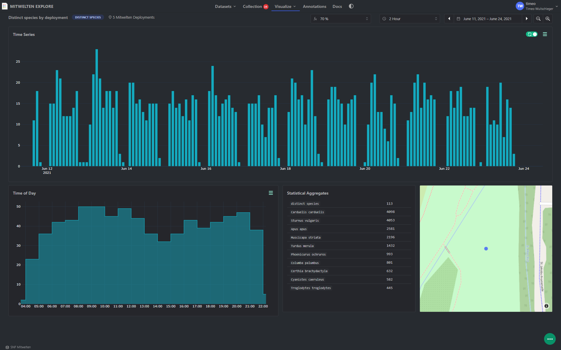
In an increasingly urbanizing world, the preservation of biodiversity in urban habitats is becoming more and more crucial. This Project is focused on the analysis of biodiversity monitoring data to provide a better understanding of it. In the research project Mitwelten, automated data collection systems were used to collect and analyze various datasets, including observations of birds, pollinators, and human presence. The data that has been collected continuously over long periods provides an interesting basis for the exploration of biodiversity. For the interpretation of the datasets, the challenge is to find the right view of the data to identify important phenomena and correlations.
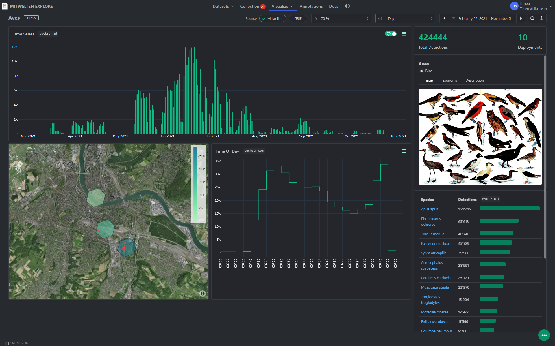
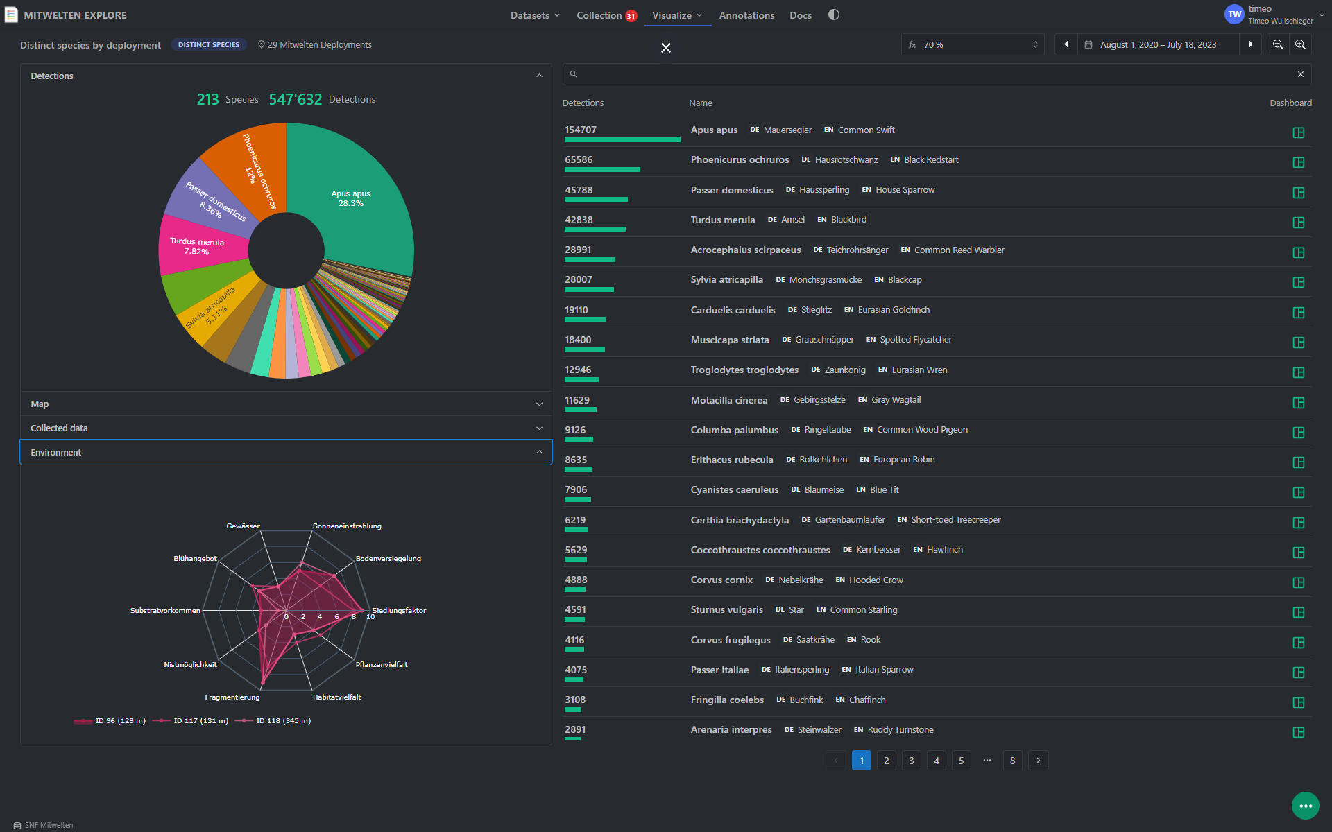
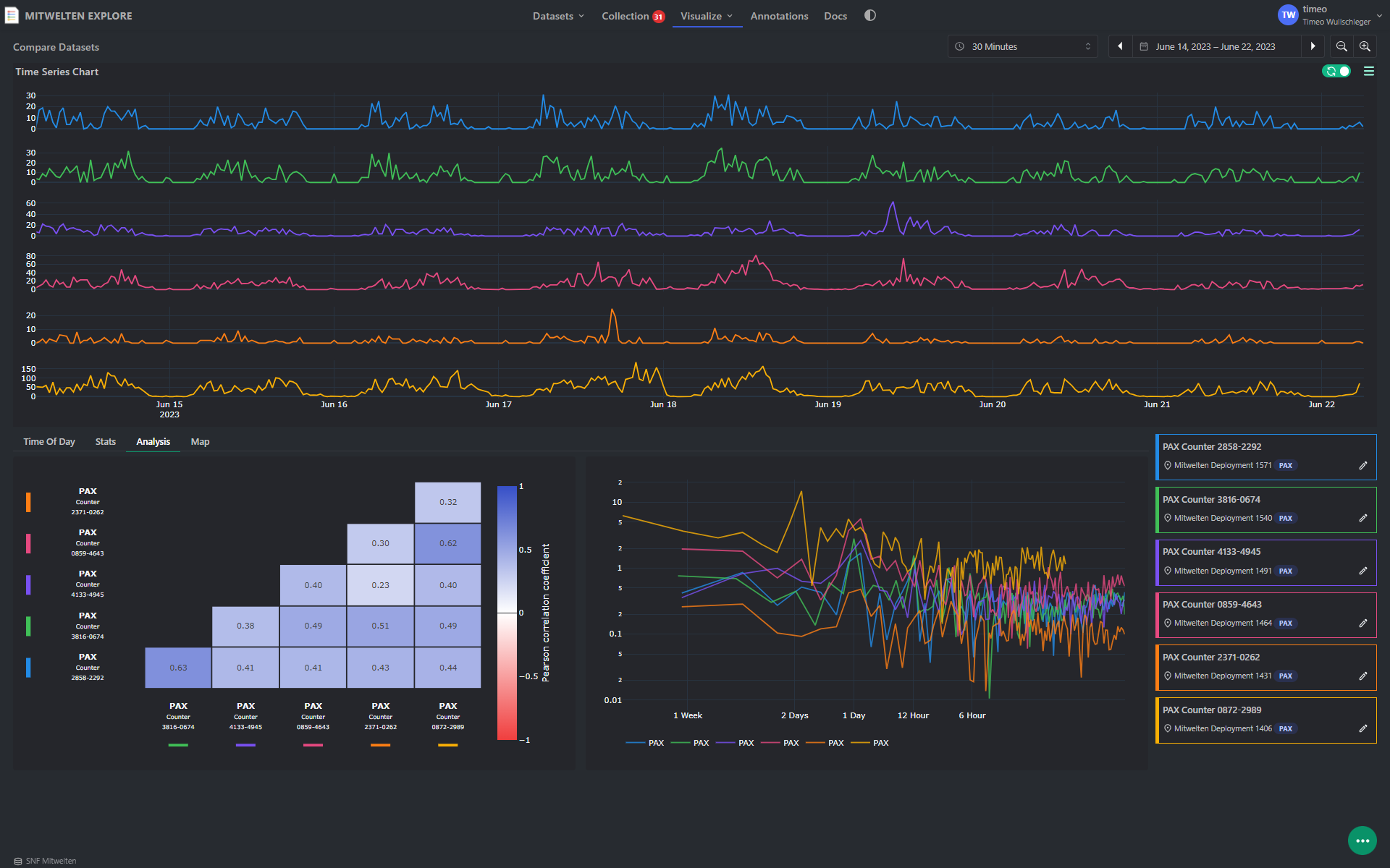
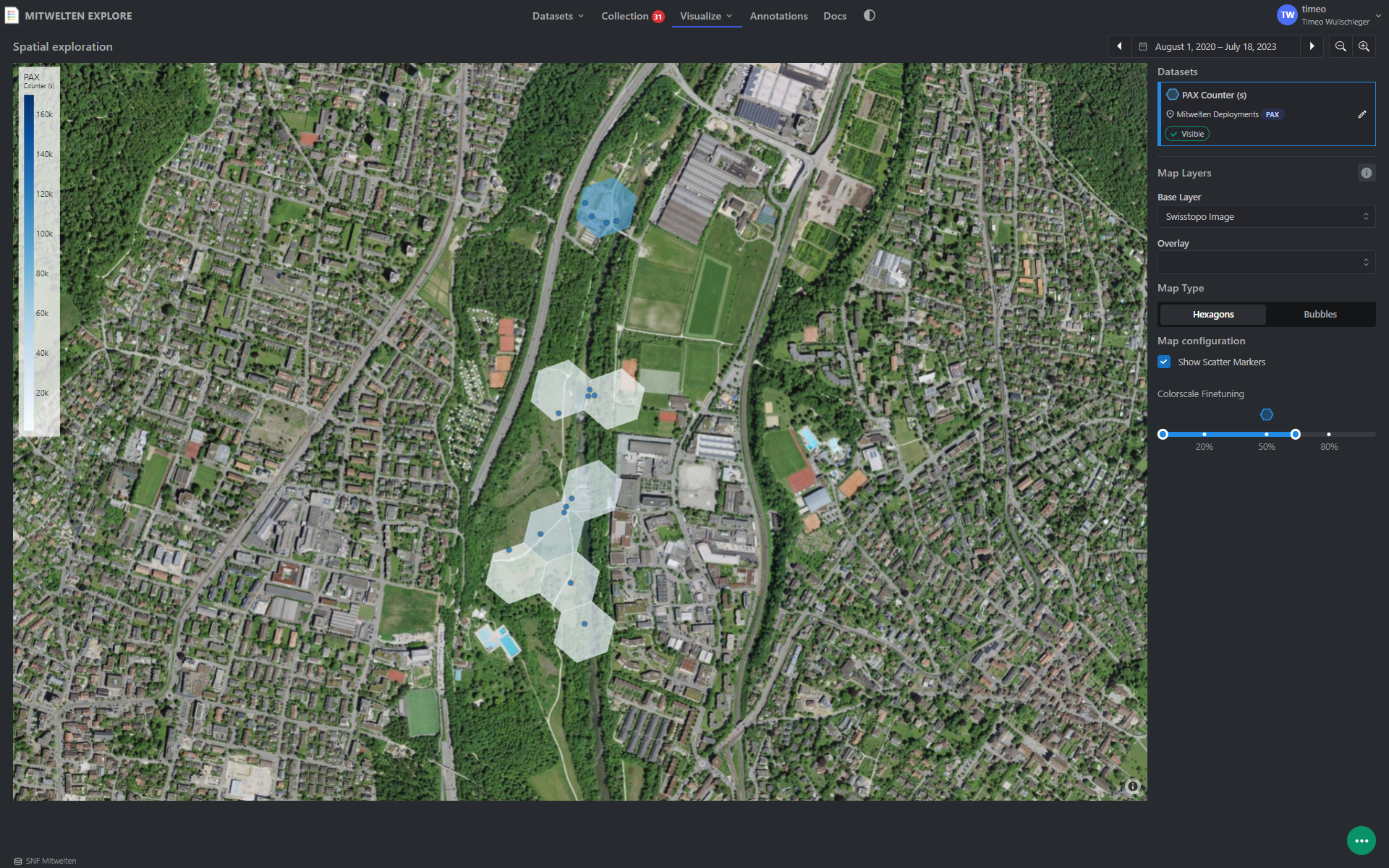
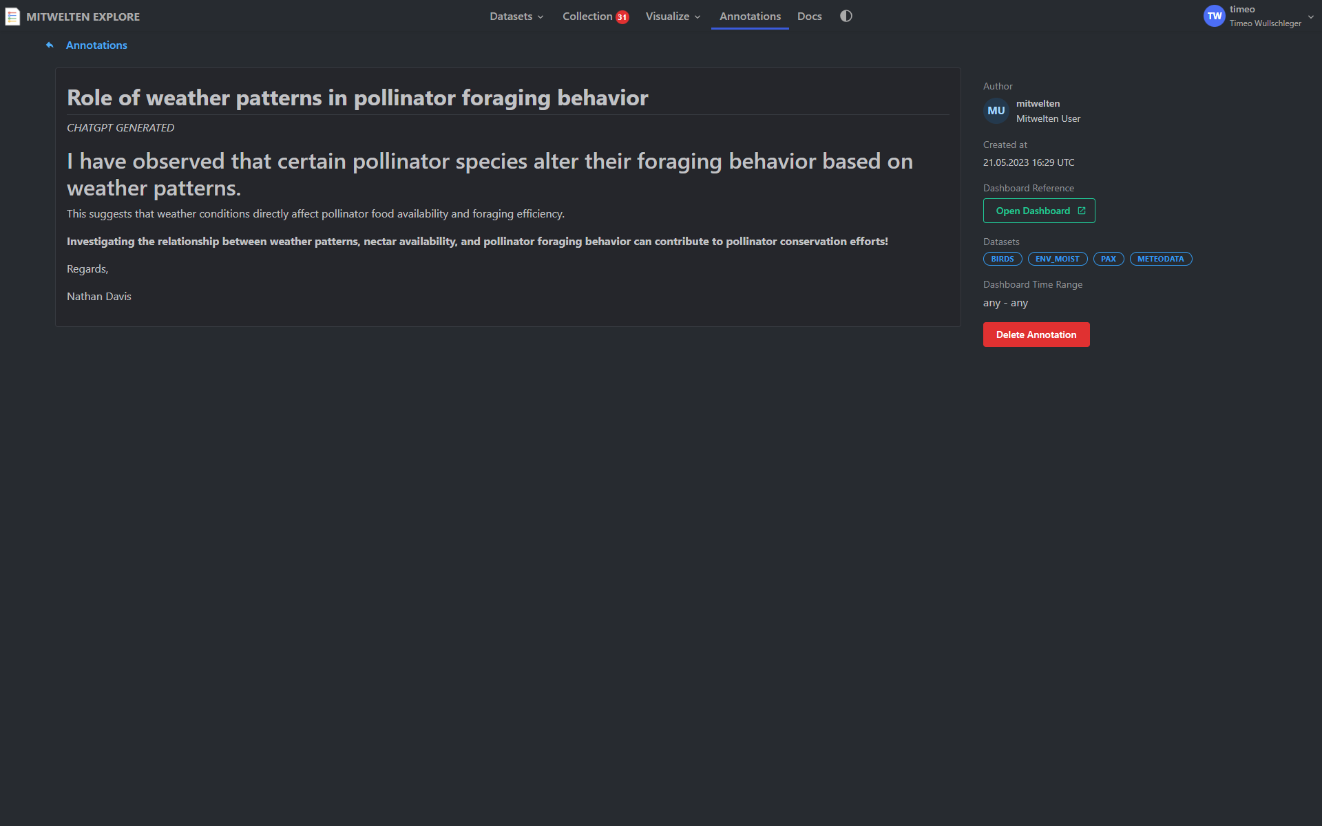
The goal of this work was to develop an interactive application, called "Mitwelten Explore", to visually explore datasets, compare them to each other, and identify patterns, trends, and correlations. In the first step, the fundamentals of UX/UI design, data visualization, and data management were elaborated. In the second phase, it was analyzed how the existing data can be filtered to explore and compare subsets of it. For the investigation of further variables influencing biodiversity, additional data from external sources, including meteorological data, were obtained. To operate the application, a clear workflow was developed, which is comparable to the operation of an online store. To enable researchers to share their findings with others, a concept for writing annotations was developed. In the final phase of the project, the application was implemented using an iterative development principle. In addition to the Explore tool, the data collected in the Mitwelten project was made available via an API to enable further analysis with third-party tools.
The developed application provides an efficient and user-friendly solution for the exploration and analysis of ecologically relevant data and contributes to an improved understanding of biodiversity in urban terrains.
Open documentation ↗Technologies
Screenshots